DISCOVERIES AT ANCIENT HELIKE
Ancient Helike Society, Athens
eliki@otenet.gr
Steven Soter
American Museum of Natural History, New York
soter@amnh.org
November 2003
Since 2000, we have excavated in the Helike delta each summer. Below is a brief summary of the principal discoveries in sequential order.
2000. Based on evidence from bore holes and ground penetrating radar, we opened trial trenches which brought to light a Byzantine building and cemetery, a massive Hellenistic wall, a paved road (all near H12 in Fig. 3), a Roman cemetery (H5), a debris deposit full of late Classical potsherds (H11). We also uncovered (near H21) foundations of walls of pre-Classical age buried in marine and lagoonal mud.
2001. We uncovered ruins of building destroyed by the earthquake of 373 BC (at H18/19). In two trenches (H21/22) we brought to light more pre-Classical walls, this time together with complete pottery vessels, which unambiguously dated the site to the Early Bronze Age (EBA). An extensive Roman industrial site was excavated at H14. In five trenches we found that the road uncovered in 2000 is of Roman age and extends at least 800 m across the plain (red line in Fig. 3).
2002. We excavated a late Classical cemetery with tile-covered graves (H25). Another trench (near H22) revealed more EBA walls. We also excavated a Hellenistic hearth (H30).
2003. An excavation southeast of H12 brought to light an extensive early Hellenistic industrial structure with pebble floors, plaster partitions, and a dozen bronze coins, mostly of Sikyon, dating from the third/second centuries BC. Excavation of a new trench in the Early Bronze Age site showed that much of the prehistoric settlement is perfectly undisturbed and intact, containing dozens of pots of various types and sizes, some preserving traces of their organic contents, including seeds. We also ran a geophysical test of the seismic reflection method in the EBA site. The data produced an image of buried structures having the same depth and orientation as the walls uncovered in adjacent trenches.
The following is an outline of the principal discoveries arranged in order of archaeological period.
ROMAN. The straight Roman road runs from NW to SE across the Helike plain, with an average width of 5-6 m. One trench shows wheel ruts. We excavated the road in seven trenches, extending over a distance of 820 m in the area between Eliki and Rizomylos. This was the main coastal road in Roman times, almost certainly the leoforos which Pausanias used in the 2nd century AD when he visited the area and reported (Appendix A) that the submerged walls of Classical Helike were still visible. We uncovered a large Roman building at the Klonis site (K), and a Roman cemetery with tile covered graves at H5 in Nikolaiika. A Roman industrial site was excavated in three trenches near H14.
HELLENISTIC. We found a large Hellenistic wall (dated by Wests Slope pottery) and alcoves (possibly from shops or a heroon) parallel to and below the Roman road in three trenches near H12. Nearby we discovered a large Hellenistic industrial complex of large basiins with pebble floors and plaster partitions, channels and deep tanks for liquid. We also excavated a Hellenistic hearth at H30.
CLASSICAL. Excavation of trenches in the mid-plain of Rizomylos (H18-19 in Fig. 3) brought to light significant architectural remains of Classical buildings at 3 m depth, buried under thick lagoonal deposits and destroyed by an earthquake. Numerous finds show that the buildings were rich. The assemblage includes an array of Classical potsherds, both fine and coarse ware, dated to the first quarter of the 4th century BC. We recovered terracotta figurines and a silver coin from Sikyon in mint condition. It bears a fine representation of Apollo wearing a laurel wreath, and the reverse shows a flying dove.
Analysis of microfauna in sediment samples suggests that a shallow inland lagoon covered the ruins of these Classical buildings. This was evidently the poros mentioned by Eratosthenes, as suggested by the interpretation of Katsonopoulou (1995). Thus the city did not sink into the depths of the Corinthian Gulf, as previously believed, but was submerged by an inland lagoon, which later silted over.
EARLY BRONZE AGE. A most significant and unexpected discovery was that of an extensive and remarkably well-preserved Early Helladic coastal settlement (EHII-IIIA, ca. 2600-2300 BC), the first ever found in Achaea. The site is in the Rizomylos area (HH21-22 in Fig. 3), about 1 kilometer from the present shore, at a depth of 3 to 5 meters below the surface. We uncovered the foundations of a corridor house and other rectilinear buildings flanking the sides of cobbled streets, together with abundant pottery.
The assemblage of vases includes open shapes (two-handled bowls, pedestal-footed and other cups, tankards and cooking pots) and closed shapes (narrow-necked jars and pithos jars). Of outstanding significance is a depas amphikypellon cup of Trojan type, the first one known from the northern Peloponnesos. The presence of luxury items, including small gold and silver ornaments, attests to the wealth of prehistoric Helike.
The sediments covering the Early Bronze Age horizon contain marine and lagoonal microfauna, showing that the ruins were submerged in seawater for some time. A long wall of one building is abruptly offset by what appears to be a seismic discontinuity (Fig. 5). This suggests that the EHII-IIIA settlement may have been destroyed and submerged by an earthquake, as happened to its Classical successor some two thousand years later.
REFERENCES (printed)
Katsonopoulou, D. (1995). Helike [in Greek]. Archaiologia 54, 40-45.
Katsonopoulou, D. (1998) The first excavation at Helike: Klonis Field [in Greek, with extended English abstract]. Ancient Helike and Aigialeia: Proceedings of the Second International Conference (D. Katsonopoulou, S. Soter & D. Schilardi, eds.), Athens, pp. 125-145.
Katsonopoulou, D. (1999). Mycenaean Helike. In Meletemata: Studies in Aegean Archaeology presented to M. Wiener, Aegaeum 20, 409-413.
Katsonopoulou, D. (2002). Helike and her territory in the light of new discoveries. In Gli Achei e l’identita etnica degli Achei d’occidente (E. Greco, ed.),Tekmeria 3, 205-216. Paestum.
Marinatos, S. (1960). Helice: a submerged town of Classical Greece. Archaeology 13, 186-193.
Marinatos, S. (1964). Archaeology and modern technique. Fulbright Review 1, 41-44.
Soter, S. (1998). Holocene uplift and subsidence of the Helike Delta, Gulf of Corinth, Greece. Coastal Tectonics (Iain Stewart & Claudio Vita-Finzi, eds.), Geological Society, London, Special Publications 146, 41-56.
Soter, S. (1999). Macroscopic seismic precursors and submarine pockmarks in the Corinth-Patras Rift, Greece. Tectonophysics 308, 275-290.
Soter, S. and D. Katsonopoulou (1999). Occupation horizons found in the search for the ancient Greek city of Helike. Geoarchaeology 14, 531-563.
Soter, S., P. Blackwelder, C. Tziavos, D. Katsonopoulou, T. Hood and C. Alvarez-Zarikian (2001). Environmental analysis of bore hole cores from the Helike Delta, Gulf of Corinth, Greece. Journal of Coastal Research 17, 95-106.
CONFERENCE ABSTRACTS (websites)
Katsonopoulou, D. & S. Soter (2003). Classical Helike and its Early Bronze Age Predecessor. Archaeological Institute of America, Annual Meeting, Jan 2003.
Katsonopoulou, D., S. Soter & I. Koukouvelas (2003). Evidence of Earthquakes in Helike from the Early Bronze Age to Roman Times.4th Symposium on Archaeometry, Athens, May 2003.
Soter, S., D. Katsonopoulou & I. Koukouvelas (2002). Archaeological Evidence of Earthquakes in the Area of Helike, Achaia, Greece, from the Early Bronze Age to Late Antiquity. Environmental Catastrophes and Recoveries in the Holocene. Brunel University, UK, Sept. 2002. |
| FIGURE CAPTIONS | |
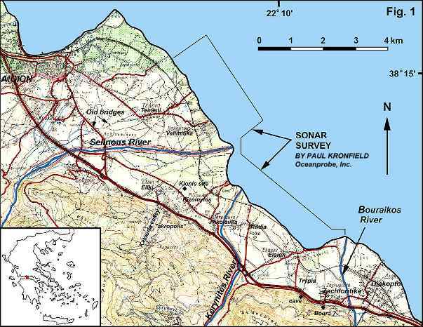
Fig. 1. The Helike search area, on the southwest shore of the Gulf of Corinth, northern Peloponnesos, including the area of the 1988 sonar survey. In 2000 and 2001 we located ancient Helike on the coastal plain between the Selinous and Kerynites Rivers. |
 |
| Fig. 2.Bronze coin of Classical Helike: obverse shows the head of Poseidon and inscription ELIK, reverse shows a trident flanked by dolphins. (Staatliche Museen zu Berlin) |  |
| Fig. 3. Topographic map of the central search area, showing trial trenches, the Roman road, and bore hole locations. |  |
| Fig. 4a. Klonis excavation site: Midway through the excavation, with tops of Roman walls revealed. |  |
| Fig 4b. Klonis excavation site: continuation of the same wall in an adjacent trench. |  |
| Fig 4c. Klonis excavation site: The end of excavation, at a depth of 3.9 m. Multiple occupation horizons are visible. |  |
| Fig 5. Early Bronze Age walls of prehistoric Helike, in trench H22. (Helike Project) |  |
THE HELIKE PROJECT 2004 - CALL FOR VOLUNTEERS
THE HELIKE
FOUNDATION: "REVEALING THE GREEK POMPEII"
|
HTML and Server by Paul Kronfield, a Friend of Helike Page last updated November 30, 2003. |  |